Flexible Area Reporting
Every airport is different, so when it comes to log position, we’ve had to work pretty hard to make Airside Logging work for everyone.
Some airfields already have predefined areas which makes it easy for us. Operators can pick an area from a list or we can show an overhead map and allow a tap on the log location.
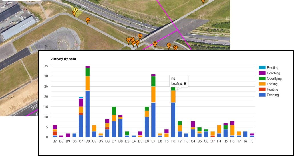
If there are no areas however, what we will do is define a grid across the whole area covered. The overhead map is shown as before and tapping on it will add in a grid square as well as the map co-ordinates to the log. Having a defined area against each log allows us to add a couple of useful area based graphs to our standard report as well as allowing you to generate your own custom graphs and reports from this information when required.
And of course, a co-ordinate in the log allows us to generate those useful annotated maps, showing log types, direction of flypasts, etc. all overlaid on your airfield.